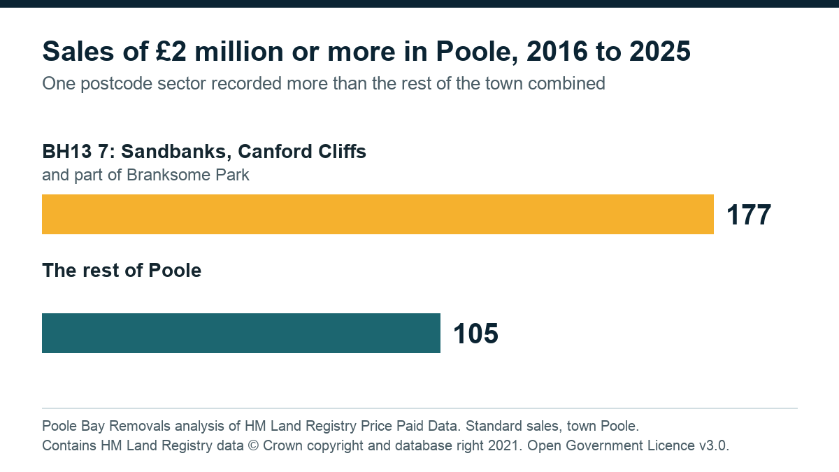
- 177sales of £2m or more in BH13 7, 2016 to 2025
- 105sales of £2m or more in the rest of Poole
- £825,000median sale in BH13 7, against £300,000 across Poole
What the figures show
- Postcode sector BH13 7, which takes in Sandbanks, Canford Cliffs and part of Branksome Park, recorded 177 sales of £2 million or more from 2016 to 2025. The rest of Poole recorded 105. Poole's total was 282, so BH13 7 had 62.8% of them.
- BH13 7 had 1,361 of Poole's 26,287 sales (5.2%), but 575 of its 1,237 sales at £1 million or more (46.5%).
- In BH13 7, 42.2% of sales were at £1 million or more. Across Poole the figure was 4.7%.
- The median sale was £825,000 in BH13 7 and £300,000 across Poole.
- Lilliput and Lower Parkstone (BH14 8) came next, with a median of £539,000 and 14.8% of sales at £1 million or more.
The full table
Sales by area, 2016 to 2025.
| Area | Sales | £2m or more | £1m or more | Share at £1m or more | Median sale |
|---|---|---|---|---|---|
| Sandbanks, Canford Cliffs, part of Branksome Park (BH13 7) | 1,361 | 177 | 575 | 42.2% | £825,000 |
| Rest of BH13 (BH13 excluding sector 7) | 1,556 | 33 | 162 | 10.4% | £362,500 |
| Lilliput and Lower Parkstone (BH14 8) | 2,538 | 70 | 376 | 14.8% | £539,000 |
| Parkstone (BH14 excluding sector 8, plus BH12) | 8,648 | 0 | 95 | 1.1% | £280,000 |
| Hamworthy (BH15 4 plus BH16 5) | 3,554 | 1 | 15 | 0.4% | £280,250 |
| Other Poole postcodes | 8,630 | 1 | 14 | 0.2% | not worked out |
| All of Poole except BH13 7 | 24,926 | 105 | 662 | 2.7% | £294,000 |
| Poole total | 26,287 | 282 | 1,237 | 4.7% | £300,000 |
Every row counts sales whose town field reads POOLE. The six area rows above "All of Poole except BH13 7" add up to the Poole total. Broadstone (BH18) is not in the table: Land Registry records those sales under the town Broadstone, not Poole.
How we counted
Source. HM Land Registry, Price Paid Data, yearly files, downloaded 10 November 2026. Page: https://www.gov.uk/government/statistical-data-sets/price-paid-data-yearly-file. Files: https://price-paid-data.publicdata.landregistry.gov.uk/pp-2016.csv through pp-2025.csv (one file per year, same folder). Each file covers sales with a transfer date from 1 January to 31 December of that year.
Range. Ten calendar years, 1 January 2016 to 31 December 2025, by date of transfer (the completion date).
Which sales. Standard price paid entries only (category A). Category B entries, such as repossessions and sales to companies, are left out.
Poole. For the Poole total and the "all of Poole except BH13 7" row, a sale counts when the file's town field reads POOLE. Across the ten files, 26,287 category A sales have town POOLE. The district field is not used, because from 2019 it reads Bournemouth, Christchurch and Poole.
Areas. Each area is a group of postcode sectors, counted only where the sale's town field reads POOLE (every sale in the named areas does; area totals checked 10 November 2026). "Other Poole postcodes" is every remaining Poole sale. A postcode sector is the postcode up to the first digit after the space, such as BH13 7. Land Registry records a postcode for every sale but fills in a locality name, such as Sandbanks, for only some: 674 of the 1,361 BH13 7 sales carry one. Counting by postcode sector covers every sale.
What BH13 7 is made of. Every BH13 7 sale in the files has town POOLE. Of its 1,361 sales, the locality field reads Canford Cliffs on 355, Sandbanks on 220, Branksome Park on 99, and is blank on 687. Of its 177 sales at £2 million or more, the locality reads Canford Cliffs on 34, Sandbanks on 28, Branksome Park on 14, and is blank on 101. Canford Cliffs as a locality name also appears outside BH13 7 (in BH14 8 and BH14 9).
Checking the headline's naming. BH13 7 includes part of Branksome Park. Leaving out every BH13 7 sale of £2 million or more whose locality is recorded as Branksome Park (14 of the 177) gives 163 for BH13 7 against 119 for the rest of Poole. The finding holds either way.
Sales, not homes. Each figure counts sales. A home sold twice in the ten years counts twice.
What it is not. It is not a count of homes, of moves or of removals. It does not include renters, sales not lodged at a price, or sales recorded under category B. It says nothing about why prices differ between areas. Poole by town name is not the old borough boundary or any ward, and the area names are a plain guide to each postcode group, not an official boundary.
Late lodgements. Land Registry updates the files monthly. Sales from 2025 can still be added, so the most recent figures may rise slightly.
Median. The middle price when all of an area's sales are put in order. Half of sales were above it and half below.
Contains HM Land Registry data © Crown copyright and database right 2021. This data is licensed under the Open Government Licence v3.0.